Surveilling the GEO Belt
Building the Future of Spaceflux Data Services
In recent years, the geostationary orbit (GEO) has become one of the most crowded and strategically important regions of space. Satellites operating there underpin communications, broadcasting, weather monitoring, and defence activities. As the number of satellites and debris fragments in GEO continues to grow, so too does the challenge of monitoring and protecting this orbital zone.
At Spaceflux Labs we are developing a dedicated GEO surveillance capability designed to meet these challenges. This approach represents a fundamental shift from the traditional tasking model of operations to one built on continuous observation. By doing so, we aim to deliver richer, more efficient services that scale with the growing complexity of space traffic.
From Tasking to Surveillance
Our existing model is built around tasking, where users request observations of specific satellites or regions. While effective, this approach can become inefficient at scale, leading to duplication of effort and occasional gaps in coverage. We have employed clever workarounds, such as side observations, but these only partially address the issue.
Surveillance offers a more sustainable alternative. By continuously monitoring the GEO belt, we can ensure more complete coverage while reducing duplication. This also allows us to reimagine how we deliver data to customers, moving away from isolated tasking and towards predictable, continuous streams of information.
Objectives and Integration
The primary objective of GEO surveillance is not only technical achievement but also seamless integration into our network operations. Surveillance must coexist with tasking without disruption, preserving the flexibility that many customers value. This requires scalable architecture, smarter scheduling, and the careful balance of resources between tasking and surveillance.
To this end, we are developing new scheduling approaches that can optimise resource allocation while enabling continuous scanning of GEO. Early prototypes test how independent sites or coordinated networks of telescopes can contribute to efficient coverage. These prototypes will eventually feed into a central catalogue, ensuring observations are shared and prioritised effectively.
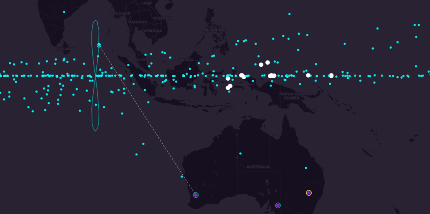
Solving the Travelling Salesman Problem
One of the major advantages of surveillance scanning is efficiency. When operating in tasking mode, a telescope must slew from one object to another and allow its instruments to settle each time before capturing data. This process introduces delays and reduces the total number of observations that can be completed in a given night. By contrast, a continuous scan across the GEO belt requires far fewer slews, minimises instrument settle times, and maximises the observing efficiency of the system. In effect, the telescope spends more time collecting valuable data and less time moving between targets.
There is also a mathematical elegance to the surveillance approach. To observe every resident space object (RSO) in GEO individually is equivalent to solving a travelling salesman problem, where each target represents a stop on the route. Tasking requires complex scheduling to optimise these routes, which becomes increasingly difficult as the number of objects grows. Surveillance scanning sidesteps this challenge. By adopting a linear scan pattern across the GEO belt, every object can be observed in a single pass. This approach is both simpler and more robust, providing complete coverage without the computational burden of constant re-optimisation.
Looking Ahead
The shift to GEO surveillance marks a step change in how Spaceflux approaches orbital monitoring. It addresses inefficiencies, meets operational demands, and establishes a scalable foundation for the future. More importantly, it prepares Spaceflux to confront the complexities of an increasingly crowded and contested orbital environment.
As we move from prototypes to operational deployment, Spaceflux will continue to refine and expand this capability. GEO surveillance is not just a technical upgrade, it is the blueprint for a new era of space situational awareness.